
Development
The original Hope Cottage was built in 1896 between the villages of Inner and Outer Hope and now forms the small lounge outside the restaurant. Inside the restaurant above the entrance door, the tiled roof of the cottage's side door can still be seen. When the 'Cottage' first opened in 1927 as a small guesthouse, it was known as Hope Cottage. The Emperor Heile Sellasie was accommodated here during some of his period of exile.
The first owner was a Miss Wade. In 1935 Miss Wade married Mr Dudley Holliday and they ran the guesthouse together. In 1936 they made the first development to the north of the original cottage. Some years later Mr and Mrs Holliday were divorced and somehow Mr Holliday managed to gain full ownership of the Hotel.
In 1949 Dudley Holliday married Clarrie, whose parents owned the Links Hotel at Thurlestone. 'The Links' is now private apartments. Dudley and Clarrie ran a very successful business and expanded the Hotel to the size it is today. Dudley Holliday passed away on 18th February 1972, aged 65, and Clarrie put the Hotel up for sale soon after. The third and present owners are the Ireland Family who purchased the Hotel in November 1973 and. after the winter break. re-opened on 31st March 1974.
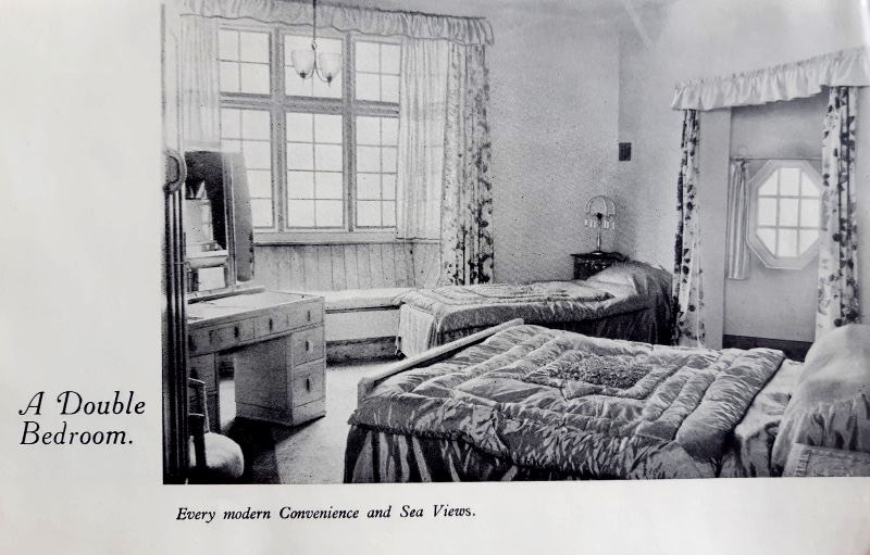
In 1927 Westerly House was built as a private residence and in 1955 it was purchased by Mr and Mrs Holliday. In 1959 the Cove room was built, and dances were held every Saturday night after dinner. In those days the guests were on full-board terms. In the late 50s the restaurant was built, joining the Hotel to Westerly House. In 1961 the 'Cottage' had 32 rooms, 5 of which had en-suite facilities.
Prior to the War glass-fronted wooden chalets were built as extra accommodation for guests, but in 1965 the Hollidays added five balcony rooms above the restaurant, which blocked the view from the chalets, so they could no longer be used. The front terrace was built in 1968. Mr and Mrs Ireland completed the deluxe rooms and balconies in 1985. By the end of March 1994 all the front-facing rooms were provided with en-suite facilities.
In Miss Wade's time there was a billiard table in the Bar Lounge, and Dudley and Clarrie had an African Grey Parrot in reception that would wolf-whistle at the ladies.

World War II
In the beginning of 1941 the Ravenscroft School for Girls in Eastbourne evacuated their pupils and for two terms they stayed in the Cottage Hotel. The main lounge was cleared and used as the classroom. After this, and until 1944, the RAF requisitioned the hotel for the fighter pilots that flew Spitfires and Hurricanes from the Airfield on Bolberry Down. In the bar lounge there are some photographs of these brave men. During their stay here the Herzogin Cecilie Cabin was the Sergeants' mess and out of bounds to anyone else.
Also on Bolberry was a secret early warning RADAR centre, so Hope Cove was quite a hive of activity during the war.
Mrs Clarrie Holliday loved Donkeys and her first one, Celina, was bought for her by Dudley and kept in the Hotel grounds down by the bungalow where the swing is. After Mrs Holliday sold the Hotel to Mr Ireland she retired to Bolberry Copse where she kept Peacocks, Pygmy Goats and eight Donkeys. The donkeys were used for rides at the weekly coffee mornings Mrs Holliday held. She was greatly missed by locals and visitors when she passed away on 15th February 1998. The donkeys went to the Sidmouth Donkey Sanctuary at her request and the other animals went to the open farm at Sorley Tunnel.
Hope Cove was a thriving fishing village and was mentioned in the Assize records of 1281. The name hope probably derives from the Norse word 'Hop' meaning bay or inlet. The main catch was pilchards and the pilchard boats were kept in the Cuckoo Pit, an extensive area that now includes the lower entrance to the Hotel. Crabs and lobsters have always been part of the main catch as well. Of course, in previous centuries, smuggling and wrecking helped supplement meagre incomes. In 1588 the Spanish Armada ship St Peter the Great was wrecked on the Shippen Rock and Hope Cove was the one of the few places in England that Spaniards came ashore.
Hope Cove had its own Lifeboat crewed by local families from 1878 to 1930. The Lifeboat Station is the building above the harbour slipway in Inner Hope. Many of the present day Auxiliary Coastguards are descended from these old families. In the early part of this century, the RNLI decided it could no longer afford to fund the boat so a private company was set up to run it, the "Hope Cove Life Boat", and it has been running since May 2011.
The breakwater and harbour walls were built in 1924 to protect the fishing fleet.
When the original Hope Cottage was built seaside holidays were neither popular nor even considered; few people swam in the sea for pleasure. But the occasional visitor or lost wanderer would knock on the door of Hope Cottage and ask for a cup of tea or even a bed for the night. It was from such humble beginnings that the present day Cottage Hotel evolved.